| Touring
routes report home page Table of Contents Previous: Lenox to Vermont border Next: Shortcuts |
|
| Touring
routes report home page Table of Contents Previous: Lenox to Vermont border Next: Shortcuts |
|
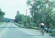
North Berkshire side trips
Cue sheet northbound | Cue sheet southbound
The side trips described on this page connect to the main north-south route between Lenox and the Vermont border.
Side Trip 8: Taconic State Forest
This short alternate route through the west end of Pittsfield foregoes a visit to Burbank Park, a city park with a waterfront; but passes Taconic State Forest with its campgrounds and picnic areas. Even if not visiting Taconic State Forest, riders may choose this route for variety, to form a loop route and to ride over the unusual causeway over Onota Lake on Dan Casey Boulevard. The loop route around Onota Lake composed of this side trip and the corresponding part of the main route is one of the easiest in the entire system of routes, ideal for weaker or inexperienced riders.
The loop made up of this side trip and the part of the main route including Burbank Park have has such great potential for novice recreational use that they deserve to be designated, signed and improved as such. Note that the route is almost flat, and bicyclists traveling clockwise never have to cross a major street or make a left turn.
Side Trip 9: Mount Greylock
Even more than side trip 2 to Bash Bish Falls, the 20-mile ride over Mount Greylock poses -- it goes without saying -- a major climbing challenge. The reward, in addition to the feeling of accomplishment, has been described by Michael Farny, author of New England Over the Handlebars, as follows: "For cyclists who want a wonderful mountain experience, Greylock offers the finest there is. At 3,491 ft., Greylock is the highest mountain in Massachusetts. Cadillac Mountain on Mt. Desert may be more exposed, Smuggler's Notch may be steeper, and Mt. Washington may be far higher, but the 16-mile route up and over Mt. Greylock is the loveliest in New England."
Mt. Washington is in any case no longer in the competition: its private, dirt road now prohibits bicycles. May this never happen on Mount Greylock, and it never needs to, since there are two roads to the top, both public and well-paved. Traffic is also far lighter than on Mount Washington, as the public Mount Greylock road is not subject of a bumpersticker publicity campaign. "This Car Climbed Mount Washington" is the ultimate challenge to every jalopy in New England, so now "This bike climbed Mt. Greylock" is the challenge to every bicyclist. Fortunately, with the low gears widely available today, even flatland bicyclists can grind their way up Greylock without undue strain.
There is a campground on the west flank and a rustic shelter at the very summit, with bunk beds and a descriptive program, run by the Appalachian Mountain Club. Mount Greylock can even be experienced as a two-day trip, with sunset and sunrise at the summit. Riders who wish to stay in the shelter should check with the Club about availability.
The trip over Mount Greylock runs between Lanesborough and North Adams, and so it can serve as one leg of a long loop ride through northern Berkshire County. Mount Greylock is easier when traveled south to north, with about 400 feet less climbing and more moderate grades.
It is in keeping with the scenic and wild character of Mount Greylock, its being a state reservation, and the limited capacity of the summit parking lot to limit motor traffic up the mountain, should that ever be necessary. The goal of visitors is to visit the top, not to fulfill a marketing strategy which creates an artificial demand to put their cars to the test, as on Mount Washington with its "this car climbed Mount Wshington bumperstickers. If demand becomes excessive, it would be appropriate, then, to limit or ban private motorcar travel up Mount Greylock, and to provide buses. Buses would be at least partly self-financing, would reduce traffic, increase safety, and maintain good bicycling conditions.
Another possible measure would be to take advantage of the two available roads to the top and make them one-way; then, faster vehicles could overtake slower ones when climbing without conflict from oncoming traffic. This strategy is not aimed only at improving bicycling conditions: on steep roads such as these, many other vehicles besides bicycles lack the power to climb as fast as safety allows. An alternate route for the end of the trip into North Adams might be needed in this case, in order to avoid excessive traffic through residential neighborhoods.
Or private motor vehicles might be prohibited from the north approach only, which is any case much less popular with motorists. In this way, the north road would become the preferred bicycle route for the ascent; bicyclists cwould travel as fast as motorists when descending the south side.
Steep descents on winding roads are hazardous for bicyclists who are not used to them. Mount Greylock is far from the only place in the Berkshires which has such a descent; and managing descents will generally not be a problem for bicyclists capable of climbing the mountain. Nonetheless, warning signs giving safe speed limits are appropriate (and not just for bicyclists); other approaches would be to offer assistance in checking over bicycles at the Visitor Center at the bottom, and to allow bicyclists to descend the mountain only if they have climbed it. A bicycle rental company on Maui in Hawaii attracts novice riders by giving them a ride to the top of the volcano Haleakala in a van. The resulting accidents could have been predicted in advance.
Side Trip 10: Williamstown
An easy, short, level route, this takes in Williams College and the Clark Art Institute. This route is suitable for riders of modest abilities; and riding in a clockwise direction avoids the need to cross Route 2. The best loop route incorporating this side trip starts at Field Park in Williamstown and proceeds east on Route 2, then south on Green River Road to Mount Hope Park, a great location for a picnic. The return is on Green River Road to Gale Road, with a stop at the Clark Art Institute. Bicyclists may also stop in the college town shopping district of Williamstown south of Route 2, with its eateries and specialty shops.
Green River Road is a valuable scenic resource; see comments on the main route.
Given its orientation toward novice bicyclists, the route does not cross Route 2 to take in the Williams College Campus. With crossing improvements, the route might extend to Cole Avenue and Massachusetts Avenue, which, if widened as suggested in the comments on the main route, would provide a pleasant route most of the way to North Adams.
Side Trip 11: Natural Bridge Circuit
There are two good routes north from North Adams to the Vermont border. The main bicycle touring route follows rural roads and passes Clarksburg State Park. The side trip follows Route 8 past the Natural Bridge State Park. The two together form a loop route for riders of intermediate or greater abilities. Though traffic outside of North Adams is light, the route must pass through the center of the town; and so it is not suitable for children or novice riders.
The best loop route is counterclockwise, since the side trip out of North Adams on Route 8 follows the north branch of the Hoosic River, with a constant, moderate climb. The return on the main route into North Adams passes Clarksburg State Park and then remains on a high, level terrace for a mile, descending rather steeply back into North Adams.
As suggested also in the comments on the main route, there is need for more research and perhaps improvements in the route through North Adams.
| Touring routes report home page Table of Contents Previous: Lenox to Vermont border Next: Shortcuts |
Prepared by John S. Allen, 1993 |
 Touring