Spring Along the Neponset River
10:00 am, Saturday, March 23, 2013
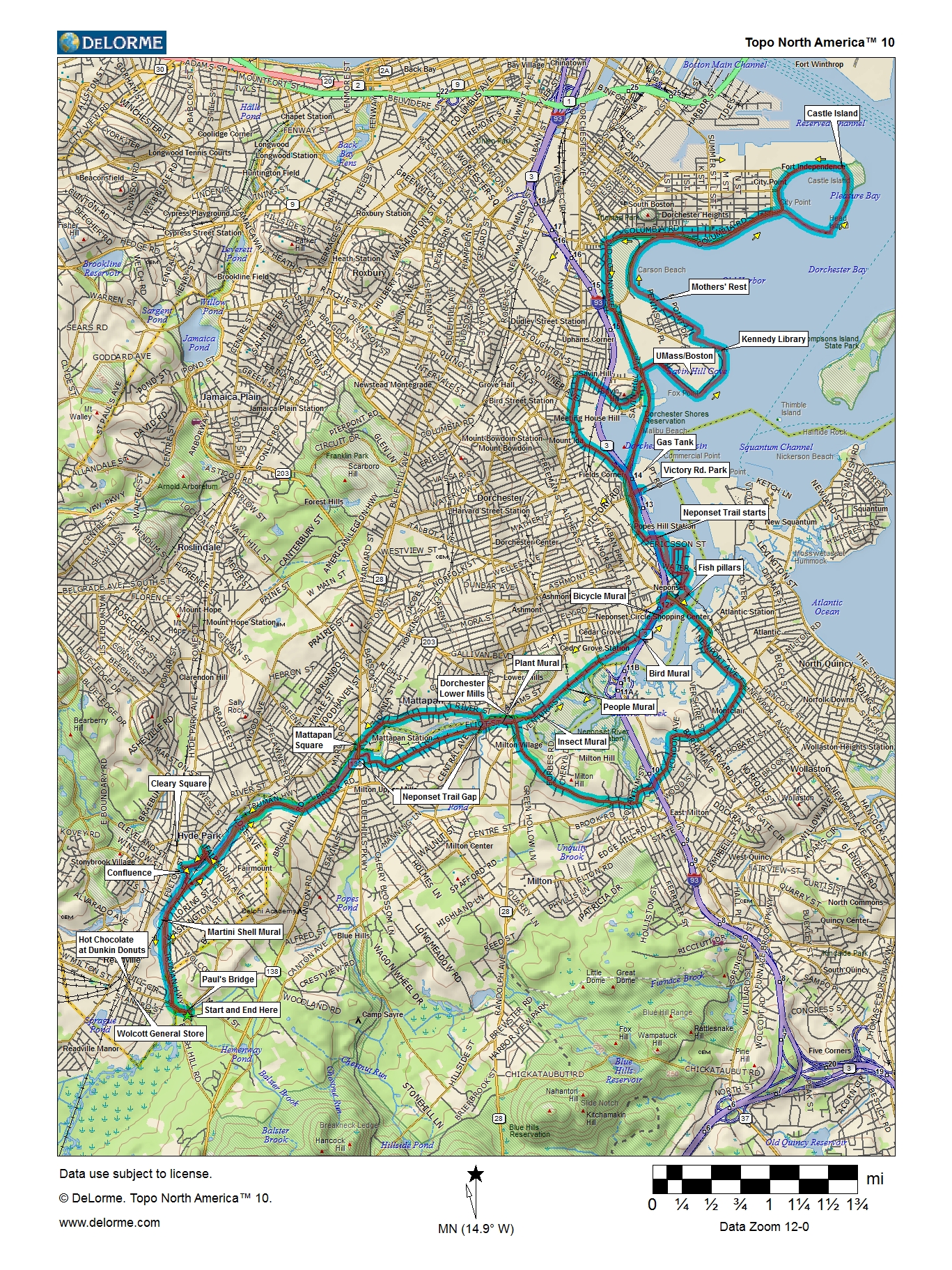
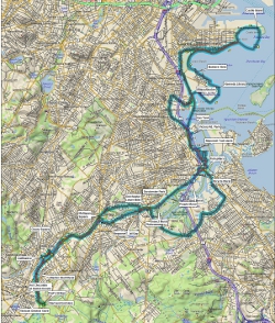
Starting at Paul's Bridge, on the northwest edge of the Blue Hills
Reservation, we will take the bike lanes on Truman Parkway north
along the Neponset River, cut through Milton along the river to the
Neponset Trail, and follow that to Tenean Beach in Dorchester.
The route of the future Dorchester Coast Trail will take us to
Columbia Point, where we'll pick up the existing paved path along
Boston Harbor past UMass/Boston, the Kennedy Library, and the
Harbor Point Apartments to Carson Beach and Castle Island.
Then we'll head back through Savin Hill to Dot. Ave. and Freeport
St., which takes us back to the Neponset Trail in Port Norfolk.
We'll cross the Neponset on the new bike lanes on the Hancock
St. Bridge and wend our way through Quincy and Milton to a great
view of the Neponset River Estuary from the top of Governor Hutchinson
Field and a view of the Lower Mills mill pond from above the trolley
on Eliot St. We'll cross back to Boston on Central Ave. and follow
River St. to Mattapan Square, where we'll pick up the new trail and
follow it south to the starting point, probably stopping for hot
chocolate or coffee at Dunkin Donuts in Wolcott Square.
This ride is sponsored by the the Boston Natural Areas Network and its community-based Neponset River Greenway Council, which have been working with the DCR to connect parklands along the river since 1990.
Photos from [this year] [2012] [2011] [2010] [2009] [2008] [2007] [2003]
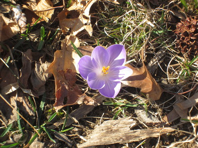
Last year, there were flowers
Details
- Where: Meet at the parking lot at Paul's Bridge and Brush Hill Road at the edge of the Blue Hills just off the Neponset Valley Parkway.
- When: Departing at 10:00 am, Saturday, March 19, 2011
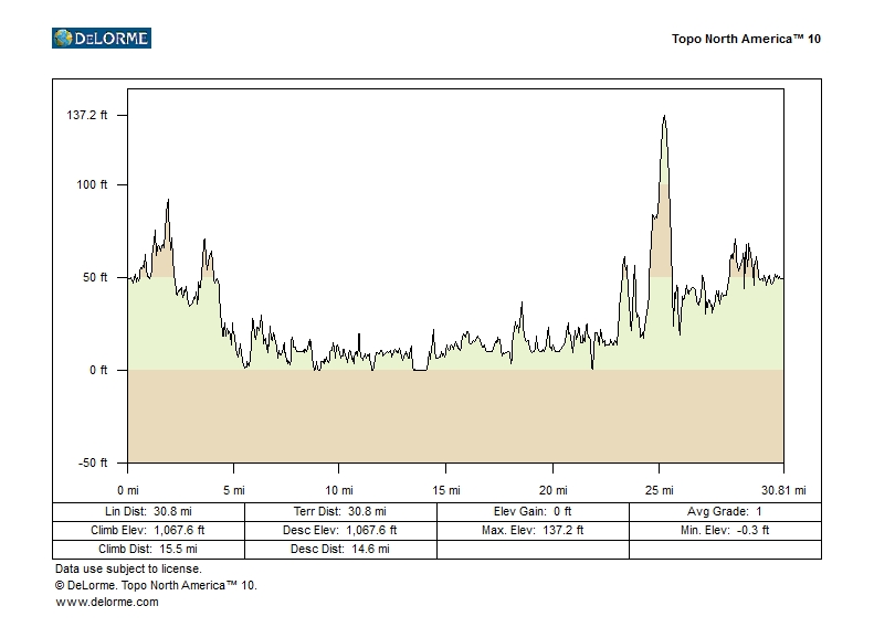
- Distance: about 31 miles.
- Pace: Relaxed, probably 6-10 MPH.
- Terrain: Mostly flat, with one significant hill.
- Route: Mixture of on-road (70%) and shared-use path (30%).
- Leader: Jessica Mink
Maps and Cue sheet
Getting There
Bicycle
Ride south from Forest Hills on Hyde Park Ave. to Readville, then turn left on the Neponset Valley Parkway to Brush Hill Rd. just after crossing the Neponset River. From the eastern part of Boston, get to Mattapan Square and follow Brush Hill Rd south.MBTA
You can take your bike on T rapid transit lines and some bus lines, (none of which go near today's ride), for no extra charge. Details are on the MBTA website.From Forest Hills (Orange Line):
Take Hyde Park Ave. to Readville and turn left on the Neponset Valley
Parkway to Paul's Bridge.
Car
Take the Route 138 exit from Route 128/93N, and go north to Brush Hill Rd. Turn left using a right turn through a jug handle.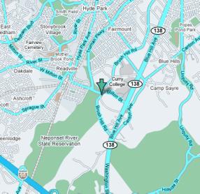
Click for Google Maps