[October 1999]
[November 1999]
[March 2000]
[May 2000]
[August 2000]
[October 2000]
[May 2001]
[October 2001]
[January 2002]
[July 2002]
[November 2002]
[March 2003]
Neponset River Trail: Paved At Last!
November 6, 2002|
The final stretch of the trail, from Granite Ave to the High Speed
Line overpass (Shawmut Junction) was paved with a permeable pavement
called
"Road Oyl".
The easement between the Southeast Expressway and the Keyspan gas tank is apparently unusable for the foreseeable future due to security concerns. The fishing pier at the end of the penninsula has also been closed to the public. The community near the gas tank feels that anything that makes the tank more secure is a Good Thing. Some of still hope that people in power will realize that security and the path can coexist, as this section is really necessary to get past a very dangerous expressway ramp onto Morrissey Boulevard. Now we have to start planning the upstream portions of the Greenway, especially the section in Milton and Hyde Park from Mattapan to Paul's Bridge at the southern edge of the city, which might consist of a rustic trail through the woods with bike lanes on the Truman Parkway, which has very few intersections over its three miles parallel to the river.
-Doug Mink,
dmink@massbike.org
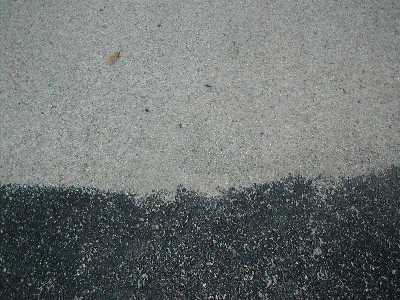
Boundary between asphalt (bottom) and "Road Oyl" (top) |
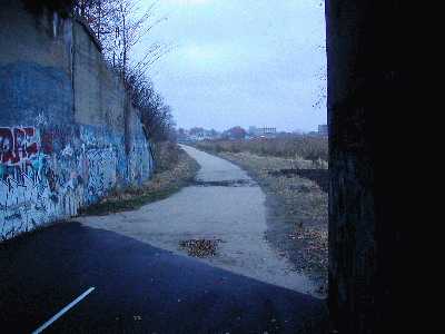
View of Neponset Trail west from Granite Ave.
|