Northampton-Northfield route description
Norwottuck rail trail photo tour
Note: this page was not part of the original report. The opinions expressed on this page are entirely the author's own.
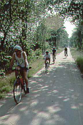
Ok, I'll call it a rail trail, that's what they are called now that the Rails to Trails Campaign has erected its big tent over the pedestrians, equestrians, inline skaters, cross-country skiers and snowmobilers who already used the, um, bike paths paid for out of bicycle funding. Like the Northampton path, the Norwottuck rail trail between Northampton and Amherst parallels Route 9. However, part of the section of Route 9 which it parallels is a commercial strip, and other parts are rural, with high speed limits and little if any shoulder width. The Norwottuck is as direct between Amherst and Northampton as Route 9, and provides back-door access to many of the businesses along Route 9.
The Norwottuck rail trail was in the final stages of construction when the research for this report was being conducted in 1993. It more fully reflects AASHTO design guidelines than the Northampton path. It does not have barriers at intersections. Nonetheless, there are a number of design compromises.
Due to the Norwottuck's usefulness in connecting trip generators and the variety of scenery, it had already proved very popular before it was completed.
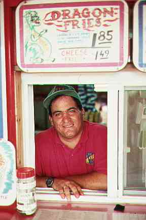
Hadley is a largely rural town and agricultural town midway between Amherst and Northampton. Many residents of the town of Hadley had opposed the construction of the trail through the center of their town. The owner of an ice cream store in Hadley, which previously had access only from Route 9,
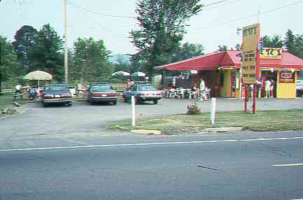
felt differently about the path: "Everyone in this town hates the path, but I love it." It certainly was good for his business.
He has installed a signpost, and a wooden bridge over a shallow ditch. The bicyclists in this photo are not using the bridge. Its design makes it trickier to navigate than the ditch.
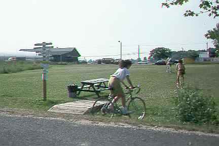
The ice cream shop owner told me that many of the other businesses along Route 9 also would be providing bicycle access and parking. The design of his bridge is a case in point that it would be useful for any bicycle path project to include design assistance for abutters to the path.
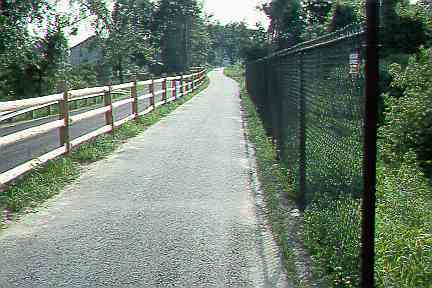
In the view below, in the center of Hadley, the fence on the left is of nonstandard design but serves a useful purpose, separating the trail from a road. On the other hand, the trail's being so close to a road exposes eastbound bicyclists riding after dark to the bright side of the beam pattern of motor vehicle headlights. If the fence on the left were a chain link fence extending above eye level, like the one on the right, it would become opaque at low angles and reduce this problem.
The fence on the right does not protect bicyclists from any hazard. The separation of both fences from the pavement is below AASHTO guidelines. Good fences make good neighbors, but the fence on the right probably reflects unhappy neighbors concerned, rightly or wrongly, about the impacts of the trail on their property.
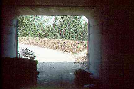
On bicycle paths and rail trails, design compromises are most common where overpasses and underpasses are needed. The abandoned railroad line originally crossed Route 9 at grade in Hadley, and at a very small angle. A culvert underpass was constructed for the path, more nearly at a right angle to Route 9. As is often the case, this underpass is rather narrow; also, the need to remain within the property lines of the railroad right of way resulted in rather sharp curves, and so in poor sightlines. Here is the exit from overpass, westbound on the path at the north side of Route 9. (The materials inside the underpass reflect the fact that the path was still under construction when this photo was taken).
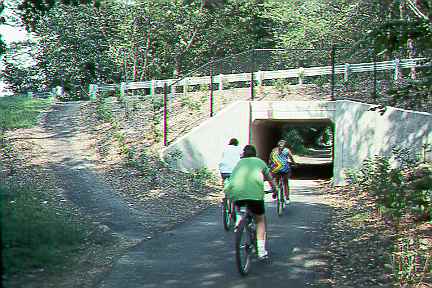
There is another similar culvert underpass at Route 47 in Amherst, an important access point. Here, the culvert is directly in line with the path at either end, so sightline problems do not occur. At least as of 1993, only a very steep connection had been provided from Route 47 to the trail. The connection is walkable but not rideable, and definitely not handicap accessible.
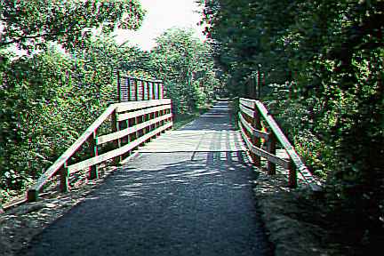
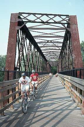
While the railings of the bridge (below) in Amherst have handlebar-height rub strips, the width between the railings does not meet the AASHTO guidelines. These guidelines specify a 2 foot shoulder, to provide shy distance and reflect the fact that bicycles, as single-track vehicles, overhang their wheel track by a foot or more on either side.
The most spectacular scenery along the Norwottuck is at its crossing of the Connecticut River between Hadley and Northampton. The trail and its railings were built inside the existing railroad bridge structure. It is interesting that despite the different substructure, the railing construction is identical to that for the short bridge in the photo above. On the Connecticut River bridge, the width problem is exacerbated because many people (like those in the right background in the photo below) stop in the middle of the bridge to view the scenery. With more imaginative design, it might have been possible to provide another two feet of space between the railings, but on the other hand, bridge construction is costly, and cost may have been a governing factor. One possible answer in a long bridge with a scenic overlook, like this one, is to provide a wider turnout in the middle of the bridge where people can stop without narrowing the width available for travel.
One other important issue about the Norwottuck deserves mention: many college students and others in the Northampton area travel by bicycle. It is impractical to keep the Norwottuck cleared of snow in winter. As of this writing (1999), there is a dispute between bicyclists who would like bicycle lanes or wider shoulders on the Coolidge Bridge on Route 9 between Northampton and Hadley, and the Massachusetts Highway Department, which has to watch its budget. To a considerable degree, the presence of the rail trail bridge reduces the cyclists' ability to apply political pressure for widening he Coolidge Bridge, because only people who use bicycles as their primary means of transportation are concerned about bicycle travel conditions in cold weather. Fair-weather bicyclists are far more numerous.