| Touring
routes report home page Table of Contents Previous: Round the Range Next: Berkshire-Connecticut Valley links |
|
| Touring
routes report home page Table of Contents Previous: Round the Range Next: Berkshire-Connecticut Valley links |
|
Other Connecticut Valley Routes
Several additional Connecticut Valley routes are indicated on the maps, but not described in full with cue sheets and written descriptions:
The River Level Route from Sunderland to the Connecticut border was recommended by bicycle club members as the most direct route down the valley. For the most part, roads are serviceable for bicycling. Much of this route is on highways which have shoulders, but carry quite heavy traffic. This is more of a utility route than a touring route.
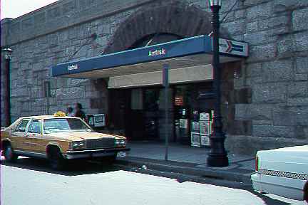
The South Hadley - Springfield Connection provides access between the system of touring routes surveyed in detail and downtown Springfield, with its cultural attractions and
Amtrak station. This route could be attractive if communities took advantage of the riverfront, as described earlier. Another, eastern route is also shown; this unavoidably includes urban riding but is acceptable for experienced adult bicyclists.
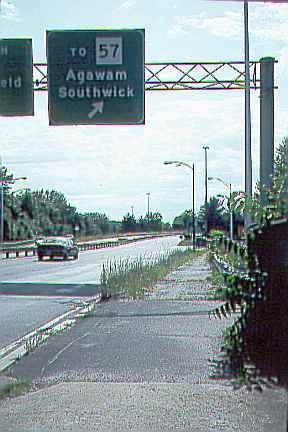
The Springfield - Southwick Connection provides access between downtown Springfield and the south end of the main touring route. This route is attractive for the most part, except for
the South End bridge across the Connecticut River.Here cyclists must use a sidewalk which is in poor condition since the only other way to travel west to east connects from a limited-access highway.
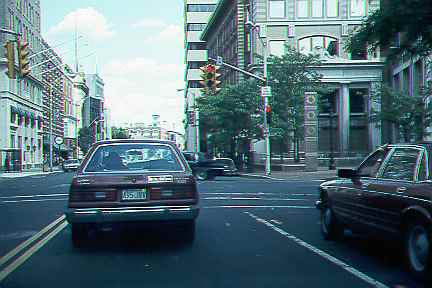
Main Street in Springfield is not bad for bicycling if you are not in a hurry: a two-way street with frequent traffic lights that slow traffic down; through traffic seeks out parallel one-way streets with timed signals. The major problem is the South End Bridge, described earlier.
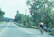
Connections into Orange and Athol provide access to services, and a way onto the touring route system from the east. The connection east from Warwick is on a very quiet road. The one into Orange from Wendell Depot is on Route 2A, which is wide and carries light to moderate traffic.
Connections between Wendell and Miller's Falls provide another east-west option and a stop at Ruggles Pond in the Wendell State Forest.
| Touring routes report home page Table of Contents Previous: Round the Range Next: Berkshire-Connecticut Valley links |
Prepared by John S. Allen, 1993 |
 Touring