| Touring
routes report home page Table of Contents Previous: Project description Next: the Berkshire Valley |
|
| Touring
routes report home page Table of Contents Previous: Project description Next: the Berkshire Valley |
|
DATA COLLECTION AND PRESENTATION
As noted above, there are different types of bicycle tourists, with different requirements for bicycle routes. Specifically:
Experienced adult touring bicyclists, the major focus of this report, typically travel between 25 and 75 miles per day, either in loop routes from a central base location, or in multi-day trips extending for 100 miles or more. Some like to stop and enjoy scenic and cultural attractions, and others just like to view the scenery from their bicycles. Due to the length of the rides these riders desire, it is generally most effective to select and sometimes improve available roads to develop through routes, as described above.
Casual bicyclists and family groups with children generally travel short distances, and want a route on a very quiet road or bicycle path with scenic or cultural attractions, little or no motor traffic and level terrain.
Some bicyclists prefer long rides in the mountains for the combination of athletic challenge and scenery. These bicyclists will pick the most remote and challenging roads.
The Core Route Concept
While no single touring route can please all categories of riders, a system of routes can. The approach taken in this project has been to build route systems around short "core" routes which are suitable for casual riders. The core routes are located in the cultural centers of the survey areas, and provide a rich selection of attractions for casual bicyclists. For example, one core route in the Berkshire Valley follows lightly-traveled roads around a lake in Pittsfield, passing through a city park with a swimming area. The core route in the Connecticut Valley makes use of two bicycle paths to pass through the college towns of Northampton and Amherst, with their busy cultural life.
Extensions to the core route invite the casual riders to expand their horizons, and serve bicyclists who seek a greater challenge or a longer ride. These extensions, along with the core routes, form through touring routes and link to other recognized touring routes in Connecticut, New York and Vermont. The extensions to the core routes offer additional scenic and cultural opportunities and attractions, as well as access into state parks, campgrounds and public swimming areas.
A ride over Mount Greylock and a century (100-mile) loop ride into the high Berkshires from Westfield are included as challenges for athletically-inclined riders.
All in all, route selection was inevitably subjective. The routes follow roads that are either lightly-traveled or of adequate width to accommodate bicycle and motor traffic without conflict; the few exceptions are where no alternative was available, and are in town centers where traffic moves slowly.
All riding is on paved roads or paths, except for a very few stretches on well-groomed dirt roads. Though the survey areas offer excellent possibilities for dirt road and off-road riding, the focus of this survey is on routes which do not slow bicyclists down, as dirt roads do, and which are manageable on conventional road-type bicycles. These routes can also, to be sure, be ridden on off-road bicycles, and can provide access to the region's many choice off-road riding locations.
The routes were not chosen to be the most direct or easiest: as touring routes, they were chosen for their interest and in some cases for their challenge. While the routes do proceed regularly, they do not proceed directly. Rather, they zigzag so as to take in as many points of interest and attractive scenic locations as are consistent with reasonable progress across the map.
The routes avoid long, steep climbs except as options. There is always an alternate route which does not involve a major athletic challenge.
Care was taken that the routes pass through town centers and other shopping areas every few miles, so that bicyclists have access to food stores, lodging and other necessary services. There are a few exceptions on routes which pass through remote areas. These will be noted in the descriptions of the individual routes.
Data Collection methods
The routes were developed by an on-the-ground survey, after reviewing existing references on bicycle routes in the survey area and consulting with local bicyclists and planning agencies. Most of the routes were surveyed by automobile, some by bicycle. The surveying permitted a review of traffic levels, pavement width and quality, terrain, scenic and cultural attractions, and linkage into through bicycle routes.
Maps, Cue Sheets and Written Comments
Description of the routes is by means of maps, cue sheets and written comments.
The maps (see appendix) are most useful for an overall view of the routes. Until a published brochure is developed, however, the cue sheets will be most helpful in examining details of the routes, since mileage counts, along with the bicycle computer, identify intersections accurately even when street signs are missing. Compass bearings also help make it clear which way to turn at an intersection, and elevation readings give an idea of the terrain. Written comments describe the reasons for decisions about routes, list scenic and cultural attractions, and explain current and potential problems which need attention in order to maintain and improve the routes.
Reading the Cue Sheets
Each entry in a cue sheet refers to one short segment of a route, and gives a number of items of information for that segment, formatted as follows:
     DIST     INSTRUCTIONS                            BEAR BEAR ALTI-
STEP READ     **SIDE TRIP CONNECTION (Asterisks)      ING  ING  TUDE
     DOWN     Note (not capitalized)                  BACK FWD  FEET

   1   0.00   NORTH from Westfield River bridge        190  010   140
                Pass under rail bridge

   2   0.11   LEFT on North Street                     190  280   140
                Old train station on left
The key words (NORTH, LEFT, etc.) in the route instructions are always capitalized. In addition to route instructions, items in the cue sheets include:
notes about points of interest, which are not capitalized;
notes about links to side trips, preceded by double asterisks;
locations of town lines, as: ADAMS -> NORTH ADAMS. These are useful to riders because town lines are often marked with signs, and to planners in working with town governments.
Cue sheets are presented in pairs for each route, one sheet for each direction of travel. The steps of each sheet of a pair correspond to those of the other -- one sheet reads down from the top and the other up from the bottom. It is possible to place the sheets next to each other and match the corresponding route segments.
The items in each cue sheet entry give the total distance traveled from the start of the route, give instructions for each turn, allow a check on route direction using a compass or the sun, and give an idea of the terrain. Some bicycle computers include altimeters, and so the elevations can also be helpful in following the routes.
The cue sheet information is accurate and reliable enough for a bicyclist to follow the route with the aid of a bicycle computer despite missing street signs -- and many street signs are missing.
Accuracy of Data
Segment distance (distance between each turn and the next) is measured from U. S. Geological Survey maps, generally with an accuracy within 5 percent. There may have been be a few measuring or data entry mistakes. Greater accuracy may be achieved by a test ride using a calibrated bicycle computer (not a car odometer, which is far less accurate).
Total distance is as accurate as segment distance or more accurate, as measuring errors tend to average out.
Instructions and notations are generally very accurate. A few street names may be absent or incorrect due to lack of data or inaccuracy of signage or maps. Massachusetts street names almost always change at town lines and sometimes elsewhere as well!
Note the different meanings of HARD RIGHT (more than a 90 degree turn); RIGHT (approximately a 90 degree turn) and BEAR RIGHT (much less than a 90 degree turn); also MERGE FROM RIGHT (the road you are on joins another from the right, like the on-ramp of a freeway interchange).
Compass bearings are taken from maps. They are generally accurate within 10 degrees except for a few possible data entry errors.
Point elevations are from maps with 10 foot or 3 meter contour intervals. Elevations are accurate within these limits, and generally interpolated to half this error or less.
Elevation gain or loss (presented in computer data only) is accurate within twice the error for point elevations. However, there may be a "surprise" climb or descent within a segment whose trend is in the opposite direction, since the segment ends do not correspond to hilltops and valley bottoms. One application of GIS might be to calculate elevation gain and loss automatically according to elevation data.
Total elevation gain (presented in computer data only) is a good indication of the athletic challenge posed by a route segment. Because segment ends are usually not at hilltops and valley bottoms, the figures in this report are typically ten to 15 percent low in rolling country; more accurate for routes in mountains with long, sustained climbs and descents, which are in any case where it is important to be warned of climbs.
Data formats and data conversion
The text of this report was created in WordStar in 1993 on a KayPro II computer and has been converted to HTML using Microsoft Word '97. The text has been reformatted, and lightly edited for clarity and updating. A few new sections, including this one, have been added.
The cue sheets for this report were prepared as spreadsheets in Microsoft Works 3.0 in 1993 on a PC laptop, then converted to text files and formatted in WordStar. For Web publication, each WordStar cue sheet was opened in Microsoft Word, and the text was copied and pasted into a new file in Word that had been saved as HTML. This procedure converted the text to preformatted HTML, preserving the monospaced formatting of the WordStar files. The cue sheets may be read into spreadsheet or database software as column-delimited tables -- though some reformatting will be needed, since many entries are on more than one line.
The original Microsoft Works spreadsheet files are included with this report and can be opened in version 3.0 or later of Microsoft Works, or in many versions of Lotus 1-2-3, though oddly, not in Microsoft Excel. The spreadsheet files include some information which is not in the cue sheets, such as elevation gain and loss, but the cue sheets are more completely formatted.
All of the HTML files created in Microsoft Word were imported into Microsoft FrontPage 1.1 for further editing, formatting and addition of hyperlinks..
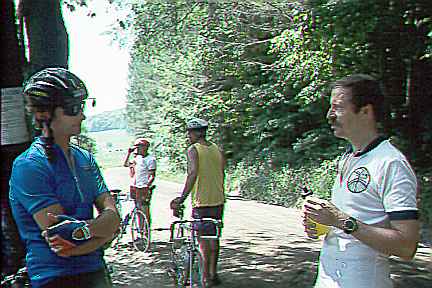
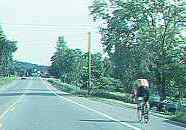
Photographs were taken during the course of research in 1993 as 35mm slides. They were scanned using an HP PhotoSmart photo scanner and processed using LView Pro software. Some new pages to hold photographs have been added to the original report for Web publication.
The emphasis in preparation of this report for the Web has been on clear presentation of the material and on efficient, fast downloading of pages rather than on fancy formatting.
| Touring routes report home page Table of Contents Previous: Project description Next: the Berkshire Valley |
Prepared by John S. Allen, 1993 |
 Touring